
Download タイドグラフBI 全国の釣り場ごとの潮見表 – 潮見表, 潮時計, 魚の釣り, 気象情報, 釣り場情報, 魚の好む時間帯
Overview
タイドグラフBI 全国の釣り場ごとの潮見表 is a specialized desktop application designed for fishing enthusiasts across Japan. Developed by B.Creation Inc., the software provides comprehensive tide data and environmental conditions for over 3,000 fishing locations nationwide. Its primary purpose is to help users identify optimal fishing times by analyzing tide patterns, weather conditions, and historical catch data. The application supports a wide range of outdoor water activities beyond fishing, including surfing, diving, and clamming, making it a versatile tool for coastal recreation.
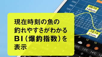
The software delivers real-time tide charts (潮見表), including water temperature, wind speed and direction, wave height, air pressure, rainfall, and lunar calendar information. A unique feature, the "BI (爆釣指数)" — or "Explosive Catch Index" — estimates the likelihood of successful fishing based on past catch records and current environmental factors. This data-driven approach aims to enhance user experience by simplifying complex environmental variables into a single actionable metric. The app is intended for both casual anglers and experienced fishermen seeking to maximize their time on the water.
While the software is described as free, the developer did not specify whether any in-app purchases or premium features are available. Platform compatibility information is limited, and exact system requirements were not listed. The application is not designed for navigation or marine safety purposes and should not be used as a substitute for official maritime guidance.
Key Features & Capabilities
- Comprehensive Tide Charts – Displays detailed tide information for 3,000 fishing locations across Japan, including high and low tide times, water levels, and tidal flow patterns.
- Environmental Data Integration – Provides real-time updates on wind direction, wind speed, wave height, air pressure, rainfall, and water temperature.
- BI (爆釣指数) Algorithm – Uses historical catch data and current environmental conditions to generate a predictive index for fishing success.
- Lunar Calendar Support – Includes traditional Japanese lunar calendar data, which many anglers consider important for fishing timing.
- Multi-Activity Support – Useful not only for fishing but also for surfing, diving, and clamming due to its detailed marine environmental data.
- Single-Screen Interface – Consolidates all essential fishing-related information into one view for quick decision-making.
These features are particularly beneficial for users planning day trips or extended fishing excursions. For example, a surfer can use the wave height and wind speed data to assess surf conditions, while a diver might prioritize water temperature and clarity. The BI index simplifies complex data into a single value, helping users quickly determine the best time to launch their activity. The integration of weather forecasts and tidal trends supports proactive planning, reducing the risk of unexpected changes in conditions.
User Interface, Workflow & Performance
The user interface appears to be optimized for quick access to critical data, with a layout focused on clarity and usability. Navigation is likely streamlined to allow users to switch between locations, view historical data, and access predictive metrics without unnecessary steps. The workflow emphasizes efficiency, enabling users to assess conditions for multiple sites in a short time.
Performance details were not specified by the developer. However, given the nature of the application—relying on real-time environmental data and predictive algorithms—it is expected to maintain responsiveness when connected to the internet. The software may require periodic data synchronization to ensure accuracy. The developer did not provide information on CPU or RAM usage, nor did they specify whether the application runs in the background or consumes significant battery power.
Stability and reliability are likely dependent on the quality of the data feed and server infrastructure. Users should expect consistent performance during regular use, but no information was provided about crash rates or error handling. The software does not appear to support offline mode, suggesting a continuous internet connection is required for full functionality.
Compatibility & System Requirements
The software is available for iOS devices, as it was originally developed as a free iPhone app. However, the desktop version’s compatibility with Windows or macOS was not specified. The developer did not provide details on the required operating system version, installation size, or hardware specifications such as processor speed or memory requirements.
Exact system requirements were not listed. The developer did not clarify whether the software supports older operating systems or requires a minimum screen resolution. It is also unclear whether the application is available as a standalone installer or through a web-based platform. Without further information, users should exercise caution when installing and ensure their system meets general software compatibility standards.
Pros and Cons
Pros
- Comprehensive tide and environmental data for over 3,000 locations in Japan
- Unique BI (爆釣指数) for predicting fishing success
- Supports multiple water-based activities: fishing, surfing, diving, clamming
- Single-screen display of all essential fishing information
- Includes traditional lunar calendar data valued by Japanese anglers
- Free to download and use
Cons
- Exact system requirements and compatibility details were not provided
- Performance and resource usage were not disclosed
- Application may require constant internet access
- Not suitable for navigation or marine safety purposes
- Desktop version availability and functionality are unclear
FAQ Section
Is タイドグラフBI available for desktop computers?
The software was originally developed as an iPhone app. The availability of a desktop version was not confirmed by the developer.
Is the app free to use?
Yes, the app is described as free. However, the developer did not specify whether premium features or in-app purchases are available.
Can I use this software offline?
Given the reliance on real-time tide and weather data, offline functionality is unlikely. A continuous internet connection is expected for full access to features.
Is the software safe to download?
As the app is distributed through official channels and developed by B.Creation Inc., it is considered secure. However, users should always verify the source before installation.
Does the software support Windows or Mac?
Platform compatibility information is limited. The developer did not provide details on whether the software supports Windows or macOS.
Final Thoughts
タイドグラフBI 全国の釣り場ごとの潮見表 offers a powerful, data-rich tool for fishing and coastal recreation in Japan. Its combination of detailed tide charts, environmental monitoring, and the unique BI index sets it apart from basic tide apps. While the desktop version’s functionality remains unclear due to limited technical details, the core features are highly relevant for anglers and outdoor enthusiasts.
For users who rely on precise environmental data to plan their activities, this software provides a valuable resource. However, the lack of system requirements, performance data, and platform clarity may deter some potential users. Despite these gaps, the app’s focus on usability, comprehensive data integration, and free access make it a strong candidate for anyone serious about fishing in Japan.
Download タイドグラフBI 全国の釣り場ごとの潮見表 now and enhance your next fishing trip with data-driven insights.